Precision Agriculture
Precision agriculture is the use of maps and location to improve farm productivity.
Ag Logic are precision and spatial agriculture specialists and have developed and refined unique mapping tools to suit Tasmanian agricultural production systems. Our services are used to manage in-field variability, optimise water flow and drainage, improve risk management or simply to create an accurate map of farm and paddock boundaries for your tractor or your office wall.
-

Mapping Variability
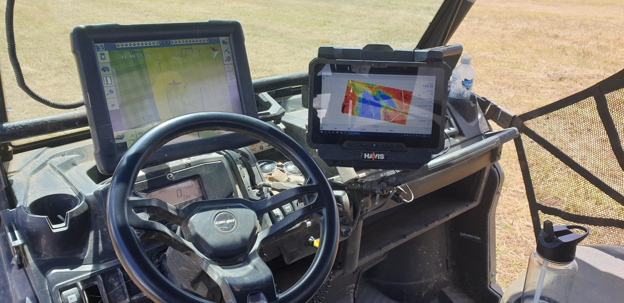
The first step in any precision agriculture process is mapping the variability of your paddock. We create base maps of your variability and then work with you to implement a range of precision agriculture inspired strategies.
Common mapping services offered by Ag Logic include elevation mapping (a key part of understanding soil water movement), EM38 mapping to provide information on soil texture variability, and soil nutrient mapping to drive variable rate fertiliser application programs. Other spatial data we use include data from drones, planes or satellite, such plant vigour maps; and yield data from harvesters.
Our role as Tasmania’s PCT AgCloud agent gives us the tools you need to action your precision ag strategies on farm. We are also able to provide full software support to help get the most out of your variable rate irrigation system.
-

Landscape Remodelling and Drainage Design
Waterlogging is the most common cause of crop loss in irrigated agriculture and improving drainage is the best solution. We create a model of your paddock using purpose-built software to analyse and improve the surface water flow. This process allows us to design and test drainage options prior to implementation. Our final designs integrate with tractor guidance and precision drainage equipment to give you the best possible outcome.
Our landscape remodelling goes further, by creating a design that reshapes the whole paddock surface with centimetre level precision to get the best drainage outcome. Accurate data, combined with our custom design processes, means we can get the best result possible while moving the least amount of soil possible. This maximises efficiency and minimises any potential harm to soil structure.
-
Mapping Your Farm
From using satellite imagery, down to using centimetre-accurate GPS, we provide a range of asset mapping services. We can create a whole farm map for your office wall, provide you with the files to load into your tractor guidance system, or we can load them for you.
We have the skills and expertise to design plans for the laying out of pivots, polytunnels or vineyards accurately, thereby reducing your waste and maximising your productivity.
